Firefox seems to be having a slight fit at the number of pictures in this post and keeps crashing. Perhaps a hint I went a little overboard with the photos? I still need to add maps, but I’ll do that when my browser decides to stop giving up the ghost.
The plan was simple. Walk over the Lairig Ghru and down to the Currour bothy. Sleep. Get up and walk the ridge of mountains to the west. At least it seemed simple at 11pm at night after a few beers.
At 10am the next morning the seven of us were standing by the bus ready to head off. It had snowed again in the night, bringing the snow level up to ‘quite deep’. It also looked like it was going to snow some more.
As we set off beneath leaden skies we immediately failed to find the path under the pristine white blanket covering the ground. After faffing around for 10 minutes and several cases of doubling back we just struck out across the heather in the hope of finding it later. We did, although even once we had a path our progress was still slow.

On the hill in the distance we could see the scar that was the Chalamain gap waiting for us. As we approached it the ground got more and more rocky, until for the last few hundred meters we had to creep over snow covered boulders with no real idea where the ankle breaking gaps in between were. We made it across and found a place out of the wind to eat lunch.


Soon we were all feeling cold, even when sheltered, so once more we began walking. The snow here was even deeper than lower down, now coming up to our knees a lot of the time. Progress was slow.


The snow got even deeper. Progress got slower. However it was hilarious to watch each other struggle and flail around.
 The gorge blocking our way to the path over the pass was getting closer and we could see just how steep the far side was. In the end we had a sketchy descent down to the beck at the followed by an interesting ascent whereby we had to kick steps all the way up.
We had another rest before beginning our final push to the top. It turned into another punishing slog through snow that was still getting deeper, and whilst absolutely knackering, it was still great to be out in so much snow. The weather was slowly improving, adding to our spirits.


At about 3:30pm we finally crested the final rise giving us views far to the south. In five and a half hours we had managed 5 miles, with 3 and a half still to go.
 A descent down a slope in waist deep snow lead up to the Pools of Dee for second lunch. By this point the cloud had lifted, giving us views of the summits. However here, and for the rest of the way to the bothy, the path would appear for 50m or so, and then disappear beneath waist deep drifts for another 100m.


I was getting hungry and fatigued, but the weather kept improving, and looking back we got a view that took the breath away.


A final push across some rough ground and a river crossing saw us to the bothy, where we all dived inside to eat and get warm. After Christmas pudding steamed in gin and whisky (I advise all of you to try this one), we all went to bed and I slept solidly until the morning. I nipped out a couple of times over the evening, and it was absolutely freezing, although by moonlight everything seemed to get more beautiful, albiet in an eeire way.

The next day started off nicely, a smattering of high cloud, but it looked to be a nice day. By the time we started walking the summit of Ben Machdui was no longer visible. As we started up the slope to the back of the bothy the weather steadily got worse. We could also now see that our planned route to the ridge was over a kilometre on the kind of terrain we’d been slogging through the previous day. Eager to avoid this we instead opted for a direct route up the Devils Point. We scrambled and kicked our way over rocks and up snow slopes, passing a couple of points I was dubious about my ability to retreat over without crampons. The weather really closed in on us to boot, with snow flurrying round us as we climbed. Surprisingly soon the gradient eased and we soon gained the summit and its welcoming shelter.


Carn Toul took hours to get to. Marching through the snow and ice in near white out conditions (all we could see was the cliff edge we walking by) combined with the cold really started to get to me a bit, and lunch was a welcome relief. It was strangely peaceful as I ate, unable to see anything but the cairn and my companions. Soon we all got cold again and so continued round the ridge.


Somewhere along here we made a navigational error (not the best thing to do in a white out) and ended up walking some way off the west side of the ridge we were following. I still don’t know how we did it. After several minutes of map reading we readjusted ourselves and luckily found the edge again.

From there we took a bearing across the summit plateau to Einich Cairn. It took a bit of courage to leave the security of the ridge, where we could see the cliff edge (albeit corniced in places) and walk into the whiteness. About 15 minutes later a cairn loomed up out of the sky/ground. We then aimed for a spot height in the middle of the plateau, but we were unable to find the top of a slight rise in the ground when there were no references at all. I admit at this point I started to get a bit nervous, as these were now the most ‘serious’ conditions I’d ever been. With the weather worsening and the summit on the edge of an almighty drop we weren’t entirely sure we’d be able to see, we decided discretion was the better option and bailed out to the north west down a very steep slope into Gleann Einich. From there we followed the track out to the road where we got ourselves picked up by other friends.


An epic two days in, for me, the most challenging conditions I’ve ever been walking in.
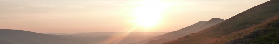
 Langdale inversion, August 2012


