Archive

Tag Archives: Wild Camping

Date: 23/08/2011

Distance: 9.4 miles

Ascent: 2600ft

We woke with no real plan for the day apart from to end up further east by the time it came to pitch that evening. We half had it in our heads to ascend Mullach Fraoch-choire, however as we were packing, the early morning mist flowing down the glen got caught on the mountain and built up before shrouding it in cloud. It put that plan to bed.

We ambled down into Glen Affric, still not knowing what to do where we promptly bumped into the couple from two days before cycling down the glen. After a bit of a chat we set off on our way once more. Soon we were at the entrance to Gleann ne Ciche and so decided to head down it on a whim to see what the high mountains further down it looked like. Instead we got distracted by the river and found a way onto an ‘island’ in the middle. Sitting around we decided to cook lunch to avoid any midges that evening. In the process of scrabbling around on rocks trying to set up the stove I managed to crack the screen of my camera. Cursing, I inspected it to discover it wasn’t fatal and my camera would live longer yet.

The Munro’s to the south also managed to get a topping of cloud whilst we cooked, and as we were chasing views we chilled out for another hour or so before heading back to Glen Affric. We decided we’d walk up Carn a’ Choire  Ghairbh as it was only a “little mountain”, totally forgetting that 865m is a damn big hill in England.

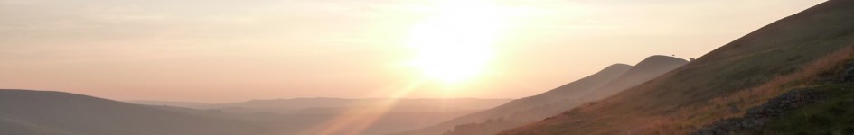
After faffing around trying to find the start of the path up its northern flank (we finally found it after deducing a slight flattening in the side of the mountain to be a path) we set off upwards. The path wound up the side of the mountain, giving views straight up Glen Affric and to the mountains beyond.

It was tough work as the hill was bigger than anticipated and the path petered out a few hundred yards from the summit. We had to pick our way across peat bog to the very bleak and cold top. We lingered for no more than a few seconds before beginning our descent into the nameless glen to the south and took a rather direct (terrifyingly steep) route, startling a massive herd of deer below who promptly stampeded off down the glen.

Once down we realised there didn’t seem to be anywhere flat enough to pitch tents. Aware that if we failed to locate anywhere it would be a long time before we had chance to rest we all kept a sharp eye out. Luckily we soon spotted a grassy area just large enough for two tents. The next day we saw nowhere else in the glen suitable to pitch.

Midges were out in force in the shelter of the mountains and we quickly retired to our tents to eat before making occasional dives outside to admire the remoteness of our location. It truly felt as if no-one had ever been there before. This was wild camping at its height.

Date: 24/08/2011

Distance: 17.3 miles

Ascent: 1700ft

The next day we woke to high grey cloud. We picked our way slowly through some very tough terrain before picking up a track into the glen two miles from our camp spot. A very disconcerting river crossing then ensued as we crossed a slippery wooden bridge that was slightly angled to the side.

Continuing along the track we dropped down into Glen Affric along a very muddy path before joining the track in the glen.  All along this section of lochside it felt a bit like I was in the Jurassic Period. Tall pines stood around, surrounded by heather, ferns and moss.

However soon the appeal of this terrain wore off, and it turned to slight despair when I realised just how far we had to follow tracks and roads to get to Cannich that evening. It wasn’t that the distance was too great, or the scenery bad, but it just seemed rather dull after our previous experiences the past three days.

We plodded and plodded for a couple of hours before finally appearing at a car park near Dog Falls. We sat and rested by the river, before walking to admire the falls. Unfortunately they are an anti-climax as the water is hidden in a very deep gorge, but you could hear the thunder of the torrent rushing through.

A very dull road walk into Cannich then followed, and we spend much of the evening sheltering under a covered area by the village hall as the rain fell for a few hours. Under cover of darkness we then found a spot to camp in the woods by the village.

The next morning we got up in the freezing dawn and got on the bus to Inverness. My first foray into the highlands was complete. The lands to the north of the border do not disappoint. Now to find the time to go back.

These past three months seem to have been swallowed by some hole in time. I’m so far behind on everything to do with this blog. Anyway, I’ve finally made some time to pen out my highlands trip from August. The plan is to do it in two parts, this being part one.

Date: 20/08/2011

Distance: 8.6 miles

Ascent: 500 feet

The train from Derby left at some silly hour in the morning (about 7am). We instantly tried to get back to sleep once boarded, which worked well for a couple of hours until a gaggle of women passed through the carriage after one station and loudly exclaimed whilst standing right next to us “Well this is a sleepy train isn’t it”. Not any more it wasn’t. They then proceeded to sit a few rows in front of us, crack open two bottles of wine, and loudly have a conversation about someone’s child. It transpired they thought rather lowly of the parents too. The whole episode pissed me off a considerable amount. Luckily we were able to escape their infuriating presence at Darlington where we changed trains. The rest of the ride north passed pretty uneventfully, we played cards, stared out at the Northumbrian coast, Forth Bridge and Scottish mountains. Inverness was reached at about 5:30pm, and the bus to Cannich caught at approximately 6pm. This particular bus journey is the scariest I’ve ever been on. The driver spent the entire journey madly gesticulating and angrily talking to himself. Coupled with the speed he was taking the roads and the ferocity of his breaking I genuinely wondered if I was going to make it to Cannich. We did get there eventually though, 12 hours after setting off from home.

And so began the nine mile walk to our camp spot for the night. The road along Glen Cannich is pleasant enough, and it was nice to pass the evening in such a way without having to think of navigation. A few midges hung in the air but they were not a problem so long as we kept moving. As evening drew in the view to the mountains opened up, giving a beautiful view to end our long day.

We finally arrived at the damn of Loch Mullardoch as darkness fell, found a suitable camp site and so stopped walking. At which point we suddenly found ourselves in a swarm of midges so dense we all panicked. I cannot really describe just how bad the next few minutes were. We scrabbled to put the tent up, pulled our bags into the porch and then dived inside.  Once out of the madness all the midges attached to our clothing decided to form their own mini swarm inside the tent. We crawled into sleeping bags, and hiding under the hood I fell asleep feeling the most miserable I have ever felt whilst backpacking.

Date: 21/08/2011

Distance: 6.5 miles

Ascent: 3700 feet

The next morning dawned bright…and still. The floor of the tent was coated in a midge paste. Thankfully that meant the inner was a place of calm. Outside we could hear a vague humming sound as the legions of winged black monsters swarmed in their thousands. Packing up was not enjoyable; I kept getting blinded as midges crawled over my eyes and every few seconds I had to run about madly hitting various parts of my body. The view east was stunning, but I only really appreciated it later that day when I had proper look at the photo I managed to snap off just before we left.

We headed south, following the Allt Fraoch-choire along a slight path. The going was tough, heathery, boggy and rocky. I was exhausted, we’d been force to skip breakfast and the previous night’s meal because of the midges, and so I was really struggling as we ascended into the mountains. After almost two hours, we reached a point where the water flowing down the mountain was clear, and so we rested for an hour, drinking, eating and enjoying the view back down to Glen Cannich.

We then made the decision that rather than take a longer, less steep route up onto the ridge; we would opt for the direct route. At first it was good going, but the gradient gradually steepened until we were at a point where one slip would result in a several hundred foot fall and probable death. The ground underfoot was pretty poor, slippery and offering little grip. Needless to say I was rather relieved when we emerged onto the eastern flank of Toll Creagach.

After another brief rest we pushed on up to the summit of Toll Creagach. The mist blew in for a while, but had cleared by the time we reached the top, giving us wonderful views to the north. By this point all concepts of completing our original route we out the window, and so we were just enjoying the day, the plan being to map out a new route over the course of that evening. Lunch was had on the summit, where we donned gloves, hats and coats. Up high the wind was strong and it felt more like autumn, a warning that the seasons were beginning to change.

We continued west along the ridge, dropping down to a col before finally finding a path and ascending Tom a Choinich.

The wind had picked up even more and at the summit it was starting to knock us around occasionally. However just as we were about to leave for the shelter of lower altitude the best rainbow I have ever seen appeared to the north. It was a magical few minutes. We hung around until it faded before heading southeast along another ridge and then descending to camp by Allt Toll Easa. Along this section the sun came out giving wonderful views to the surrounding mountains.

In an aim to be pitched before any midges came out we finished the day well before dusk (this was our plan for every night), setting up our tents at the unusually early time of 4pm. The rest of the day was spent lazing about until the midges became a nuisance and we went to bed.

Date: 22/08/2011

Distance: 14.4 miles

Ascent: 4800 feet

Packing up was a quick affair; we wanted to be walking as soon as possible. We followed a vague path down into Glean nam Fiadh, making very fast progress south until we reached Glen Affric.

We rested where the road crosses the river, taking in the beauty of this wonderful place. As an added bonus there were very few people this far up the Glen, only one or two cars passed us as we walked west to the end of the road and then took the track to continue along Loch Affric.

A few miles further and we rested once more, fuelling up on cheese, chorizo and chocolate, before starting the long ascent to the summit of Mam Sodhail.

An hour later and we were at 900m, eating yet more chorizo and cheese before the final push up to the top. The final stretch to the summit was one of lactic acid and just as we were almost there, the mist blew in, turning our world into a sphere a few meters across.


Checking our watches we decided there was time to make the out and back trip to Carn Eige. Dropping down to the col between the two mountains we saw glimpses of views through ragged gaps in the cloud. All too soon we found ourselves ascending once more, but as we climbed the mist kept rising, meaning that as we summited a full panorama was revealed. We stood on that summit drinking in the views. All the time the cloud from the surrounding mountains was also lifting until we could see both the east and west coasts of Scotland from our one vantage point.

Soon enough the time came to backtrack up to Mam Sodhail once more, and after another steep ascent we arrived on the summit again, this time is a world of sunshine. Here we met a very friendly chap who we got talking to. He asked us to join him as he walked, but as we were heading in the opposite direction we declined.


As we walked west the weather continued to improve giving us panoramas in every direction, with views to Skye and beyond. After picking our way across a rock strewn landscape we began to descend down to a col.


As we neared it our hearts sank as we saw that the area we had wanted to pitch was a massive peat bog. The map had suggested we’d be camping in would be similar to the previous night, as so this was a bit of a shock.


Once at the col we passed back into the Glen Affric watershed and found a patch of bog that seemed fine before watching the mountains to the south light up in flame as the sun set.

Date: 14/04/11

Distance: 20.2 miles

Ascent: 3796 feet

We hopped on the Transpeak to Bakewell at Derby Bus Station for a measly £2.05. An hour later we stood in Bakewell town centre, and after a brief fumbling of packs were off for our night on the moors. I had some new kit to try out, my new Scarpa SL’s, Osprey Exos and some Exped Dry Bags (I’ve never used dry bags before, and it was interesting to see their many limitations, but more on all that technical stuff soon).

Our route took us over Bakewell Golf Course and then up through woods until we emerged on Carlton Pastures. Views were rather limited as there was a dense haze in the sky, but the weather was clement enough, with the sun out it would have been roasting! We covered the easy terrain quickly, and passed through Endensor and the Chatsworth Esate without pause before slogging our way up to the hunting tower.

After a brief pause we set off once more, this time in the direction of Dobb Edge. After following tracks through the woods and into some fields we lost the path and ended up on the wrong side of a fence. A flurry of activity later and we were back on track. It was only a short distance down to the Robin Hood Inn and en route we debated whether or not to go in for a pint, we decided not to, and opted instead for lunch on Birchin Edge and a bit of bouldering on the Three Ships. Up high there was a wind blowing, and so I found myself putting my fleece over my base layer to keep out the worst of it whilst I ate.

We then continued on our traverse of the edges, crossing the perpetually boggy area to the north of Birchen, before walking along the road to the Curbar Gap. Once there we headed along Curbar and Froggart Edges, giving their ever fantastic vistas, although it remained hazy. All too soon we found ourselves at the A625. We crossed and headed into Hay Wood and the weaving mass of paths it entails. After opting to stick to the high ground whenever we could, we eventually ended up at Oaks Wood and then followed what we thought was a footpath cutting the corner of a field, but it suddenly petered out. We crossed anyway, ending deposited in the Longshaw Estate.

After walking across the corner of the estate we crossed Burbage Brook and ascended up onto Over Owler Tor. We then decided to accompany Will, who was only with us for the day, down into Hathersage (good friends as we are). We took the opportunity to refill bottles and after another snack we headed back up onto high ground once more, arriving at Stanage at about 18:30, and bar the odd climber the place was unusually deserted.

Now tired, and craving a hot meal we picked up the pace for the last mile or so, keeping an eye out for a good place to spend the night down on Moscar Moor. I quickly spotted one, and we dropped down to investigate. It turned out to be a fantastic pitch, as flat as could be hoped for, and on cropped, stone free grass. We sat around, watching the sky darken, before turning in at around 10pm.

Date: 12/06/2010

Distance: 15.4 miles

Ascent: 1950 feet


We woke at 6am, packing up as fast as we could. We were walking by 6:20, in a beautiful and clear morning.

Dropping down to the young River Derwent if felt good to be up so early and out before everyone else. Once at the river we stopped, planning to eat a large breakfast of porridge and to refill water, only to find I’d somehow got the matches wet. No breakfast us. The walk along the Upper Derwent Valley was a pleasant one, and we made good speed, soon arriving at our turning to head up to Howden Edge. Height was gained quickly and we stopped on the summit of Margery Hill to eat a breakfast of sorts (our lunch).

We set off once more, down to southern end of Howden Edge before cutting east across the moor, to join up with the path that would lead to Back Tor. Most of the hares and pheasants in Derbyshire seemed to be on that mile stretch of moor and we were given several shocks when the locals finally made a break for it, sometimes when we were just about to step on them.

We met the path soon after out final encounter with the wildlife and turned south once more, heading along the paved path to meet and then follow Derwent Edge down to Whinstone Lee Tor. There we dropped down to the road, which we followed to the Ladybower’s Dam. This was duly crossed and we followed the fields to Bamford, before getting on the train back home.

Date: 23/08/2010

Distance: 18.5 miles

Ascent: 3050 feet


The skies were heavily laden when we woke on the third day and sure enough the rain began to fall just as we set off. As we progressed along Borrowdale the rain became increasingly heavy.

When we reached the A6 Callum decided he’d had enough and was going to call a premature end to his trip (which I don’t blame him for given this was his first foray into backpacking; his feet were in a bad way and it was pissing it down). A decision was taken that we would accompany him down to Garnett Bridge; there was little point heading out across pathless fell anyway, before making our decision as to where we would aim for that evening.

We ate lunch in Garnett Bridge during a break in the weather before making our goodbyes and heading north into Long Sleddale just as the heavens opened once more. It thrashed it down. And not in the sense of a passing shower, just to change the map over we had to take shelter in an open garage otherwise the map would have been ruined. I consigned everything to being soaked (somehow my bag remained dry under its waterproof cover) and even started to enjoy myself.

We took the path over the pass between Green Quarter Fell and Shipman Knotts and down into Kentmere when the weather started to brighten up, giving beautiful skies. Walking down into Kentmere gave me a real sense of the feeling I was doing what humans should be, in the outdoors despite the rain. I tried my best to capture it on camera but non of my attempts do the scene justice.

Once in Kentmere we headed over the Garburn Pass as the day drew to a close and into Troutbeck where found a spot to camp for the night.

Date: 22/08/2010

Distance: 15.0 miles

Ascent: 3650 feet


The day dawned brightly but I was not around to see it. We all lay slumbering in our tents until gone 9:00 and so upon awakening we packed away with reasonable haste before finally setting off at 10:00am.

The first section of the day led us through the village of Dent, a picturesque place still sporting its cobbled streets before heading up onto Long Moor. We saw no-one else as we followed the vague paths to Branthwaites, with the Howgills looming on the horizon to the north and the Dales disappearing to our south. We then dropped down to the A684 and followed it, for a mile and a half long game of car dodging, into Sedbergh. Once we had been greeting by the signs into Englands on Book Town we found a convenient bench and sat down for lunch.

Dent Dale from the north

Seemingly endless moor

After eating we headed up through a jitty (an alley to those of you unversed in Derbyshire, and according to Google also Leicestershire, talk) onto the flanks of the south Howgills following the path up Arrant Haw. The ascent was a horrendous slog permeated only by two stops, once to refill water at a spring and once to watch a selection of runners partaking in a fell race. Once up on Arrant Haw we spend half an hour lazing in the sun and would have lingered much longer had a cold wind not picked up.

Arrant Haw

Dropping down to the main path up to The Calf we caught the tail end of the last group who were marching up seeming solely intent upon reaching the highest point of this group of fells. It still amazes me people have this attitude towards climbing hills. Whilst hill lists and the like are good guides, they give me ideas of new areas to walk and new mountains to climb, I cannot understand why anyone would rigidly stick to climbing only certain hills because they happen to be in a book someone compiled or because it’s the highest hill in the area.

The Calf Massif

Once we reached the summit of The Calf we lingered for as little time as possible, just to drink some water before heading off, the wind giving a serious edge to the temperature and the weather now adding ever more to the atmospheric bleakness of the northern Howgills spread out before us. This is somewhere I very much would like to return.

From the summit we followed the broad ridge north before turning west up to Fell Head, Linghaw and then down into the Lune Valley. Just as an addition to my earlier point, we met no-one from The Calf all the way to our camp in Lower Borrowdale even though we were walking through beautiful landscapes. We ambled along, crossing the Lune before walking under the M6 and railway into Borrowdale finding a place to camp a mile or so into the valley.

The Lune Valley, M6 ‘n all.

Date: 12/06/10

Distance: 16 Miles

Acsent: 2600 feet

With exams over (the day before) we headed to into the Peak District for a two day circuit of the Derwent Watershed. Setting off from Edale late in the morning we made quick progress through the haze up onto Kinder following the Pennine Way. Stopping at Kinder Low for a bite to eat the weather was both dull and cold, feeling more like March than June, so a typical British summer.

Into the gloom and murk

We then headed, continuing along the Pennine Way, past Kinder Downfall and over Featherbed Moss down to the Snake Pass.I mentioned in my last report about the lack of water we’d been receiving and even with the unseasonal quantities over the previous days there is still a shocking shortage up there. Kinder Reservoir is terribly low, with the black peat of the bottom of the lake completely exposed for quite an area on its eastern shore.

Featherbed Moss

After a brief break, we then continued up to Bleaklow Head, following the path in pleasant and warm conditions. Upon arriving at the ‘summit’ of Bleaklow, we sat around enjoying the views and relaxing, so much so that the two of us nearly went to sleep! The hardest section of the day still lay ahead, the crossing of Bleaklow to our camp spot in Lower Small Clough.

Looking over Kinder in the distance

Towards Bleaklow Head

Following the path across Bleaklow a five minute lapse in concentration sent us off following a sheep path and several hundred meters off route. Our mental tiredness was beginning to show (not helped by minimal sleep due a gig the night before) and we had to force ourselves to concentrate for the last few miles whilst we walked some of the bleakest, and in my eyes, most beautiful areas of moorland in this part of the country.

The expanse of the Howden Moors from the Bleaklow Stones.

A rather large suprise to come up against at the end of a long day.

We reached our pitch for the night knackered from our day’s travels, so after a large evening meal we turned in for the night at 7:30 to the sound of birds and running water.

It’s nearing summer again and we’re starting to think of where we intend to go for our summer backpack. Scotland is out of the question as it costs too much to get up there for only a week (over a hundred quid on the train one way). Time restrictions mean that we can’t do the coast to coast and we don’t feel like sticking to one area (i.e. the Lakes or Snowdonia). So we’ve ended up with an outline of a route that looks really varied and should be loads of fun. The idea is to get up to the Dales by train, before heading north over possibly Whernside, Ingleborough and through Dentdale. A crossing the Howgills shall then entail, before making a long winded crossing of Lakeland to take in a path along the western side of Thirlmere that we walked last year on Duke of Edinburgh Gold and really want to do again.